Roots of deadly 2010 India flood identified; Findings could improve warnings
On the night of Aug. 5, 2010, as residents slept, water began rushing through Leh, an Indian town in a high desert valley in the Himalayas. Average total rainfall in the area for August is about a half-inch. During this 24-hour period more than 8 inches fell, causing severe damage and leaving 193 dead, hundreds missing and thousands homeless.
"Flash flooding events don't happen often but when they do they are some of the scariest, most dangerous and quickest natural disasters that can happen," said Kristen Rasmussen, a University of Washington graduate student in atmospheric sciences. "But now that we know what types of conditions to look out for, flash flood warnings in remote regions of India might be possible."
Rasmussen and Robert Houze, a UW professor in atmospheric sciences, studied satellite images and what's called re-analysis data to piece together what happened to create such a torrential downpour. Their conclusions -- including that the flash flood was set off by a string of unusual weather events not unlike those that caused devastating flash floods in Colorado and South Dakota in the 1970s -- appear in the Nov. 14 Bulletin of the American Meteorological Society.
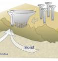
They found that on three consecutive days clouds formed high in the mountains to the east over the Tibetan Plateau. By itself, that isn't uncommon, Rasmussen said.
"What's different in this case is that there was the unusual wind coming from the east and blowing west," she said. That helped the clouds clump together and build into a larger storm system capable of creating heavy rain over Leh, which is 11,480 feet above sea level.
At the same time, low-level winds carried in moisture from both the Bay of Bengal and the Arabian Sea. "The storm, forming just up the slope, was able to tap into that additional moisture," she said.
Typically, such large storm systems don't have the chance to build because each day as the sun sets, the warm air that has helped the clouds form and lift gets cooler. The clouds then die out in the evening. But during those three days of August 2010, the unusual wind blew through the night, spurring the clouds to continue building into a system capable of heavy rain.
Above-average rain fell on the first two days. Since the region typically gets so little rainfall, the soil doesn't absorb water well.
"The key is that this happened for three successive days. If the third day hadn't happened or if the first two days hadn't set the process in motion, there probably wouldn't have been such a devastating flash flood," Rasmussen said.
The situation is reminiscent of weather that caused deadly flooding through the Big Thompson Canyon in Colorado in 1976 and the Black Hills of South Dakota in 1972. In all three cases, large organized clouds gathered high in the mountains and drew moisture up the slope of the mountain into the storms.
The resulting heavy rains are uncommon in mountains, where there typically isn't enough moisture to cause such dramatic rain. They are also more dangerous than storms in the plains, where water can spread more evenly. In the mountains, the water is funneled into valleys where it accumulates into a narrow space and can form a flash flood.
"A flash flooding-type storm could be moved out onto the plains and simply cause rain across a wide area. But in the right place at the wrong time it can be devastating," Rasmussen said.
Now that researchers have identified these common elements, including organized clouds high in the mountains on the edge of an arid plain with unusual access to moisture, weather forecasters can potentially warn people who could be in danger if a flash flood happens, she said.
There were some differences between the U.S. floods and the Leh incident. For instance, in the U.S., the storms didn't move very much. In Leh, for three days the storms moved along the Tibetan plateau but all the rain funneled into the valley where Leh is situated.
In addition to viewing satellite images, Rasmussen and Houze examined data created by using observations of actual conditions to adjust forecasts in retrospect. This re-analysis data included information collected from surface measurements and weather balloons that track things like pressure patterns and moisture in the region. The researchers also recently completed a high-resolution modeling study confirming the findings in the paper.
The National Science Foundation and NASA funded the research.
Source: University of Washington
Other sources
- Roots of Deadly 2010 India Flood Identified; Findings Could Improve Warningsfrom Newswise - ScinewsTue, 13 Nov 2012, 21:00:54 UTC
- Roots of deadly 2010 India flood identified; Findings could improve warningsfrom Science DailyTue, 13 Nov 2012, 21:00:43 UTC
- Roots of deadly 2010 India flood identified; Findings could improve warningsfrom PhysorgTue, 13 Nov 2012, 20:30:32 UTC
- Deadly Nepal flood due to 'small rockslide'from PhysorgTue, 13 Nov 2012, 9:30:33 UTC
