Researcher studies 'middle ground' of sea-level change
Related images
(click to enlarge)
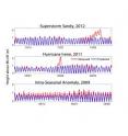
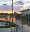
The effects of storm surge and sea-level rise have become topics of everyday conversation in the days and weeks following Hurricane Sandy's catastrophic landfall along the mid-Atlantic coast. Ongoing research by professor John Brubaker of the Virginia Institute of Marine Science is throwing light on another, less-familiar component of sea-level variability -- the "intra-seasonal" changes that occupy the middle ground between rapid, storm-related surges in sea level and the long-term increase in sea level due to global climate change.
"These are cases when the water is just 'running high,'" says Brubaker, "but not from an obvious direct cause of a storm. It isn't necessarily windy, it's just an elevated water level without a clear cause."
Intra-seasonal variability -- which Brubaker says takes place on time-scales of 10 to 90 days and can add or detract a foot or more from the predicted tide -- is likely due to shifts in oceanic currents and large-scale movements of water masses along the coast. It often goes unacknowledged in discussions of sea-level trends, but can play an important role in water-level forecasts, coastal activities, and ecosystem health.
"Intra-seasonal variability has significant impacts," says Brubaker. "For instance, being aware of these non-tidal, non-storm anomalies is very important for forecasting. If you're experiencing a relative high during the approach of a storm, with water levels already elevated by a foot or more above predicted tides, that could make a big difference in terms of storm surge and coastal flooding." Indeed, graduate student Carissa Wilkerson, whom Brubaker co-advises, is studying how intra-seasonal anomalies combine with storm surge as part of her Master's research at VIMS.
Brubaker, who teams with researchers John Boon and David Forrest on the Tidewatch Forecast system at VIMS, says the Tidewatch forecasts account for at least some part of intra-seasonal variability by using as their starting point a moving average of the most recent 30 days of sea-level measurements. Other forecasts use mean sea level, a tidal datum that NOAA defines as the average measured over the years 1983-2001.
Brubaker notes that intra-seasonal variability can also impact marine life, most notably underwater grasses. Dr. JJ Orth, head of the Seagrass Monitoring and Restoration Program at VIMS, raised concern during a period of unusually high water in May 2011, noting that "with water levels this high above predicted, it means less light for seagrasses, and with light declining exponentially with depth it could mean added stress to plants at the deeper edges of the grass beds."
Periods of unusually low water could also affect seagrasses and other marine life, says Brubaker, but the impacts are likely to be less significant because the long-term rise in sea level tempers their effects.
The Summer 2009 Event
Brubaker's interest in intra-seasonal variability was piqued during summer 2009 -- when a prolonged period of high water affected the U.S. East Coast -- and again during the shorter period of unusually high water during May 2011, which he experienced first-hand while teaching a course at VIMS' Eastern Shore Lab in the seaside village of Wachapreague.
"The 2009 event got a lot of attention -- eventually," says Brubaker. "It wasn't dramatic and it took quite a while to gain much attention, but at some point NOAA posted a notice about it in response to questions and concerns from the public, who had noticed week after week of abnormally high tides."
Three NOAA scientists, Bill Sweet, Chris Zervas, and Stephen Gill, subsequently issued a technical report to describe and explain the 2009 event. They note that water levels of 0.6 to 2.0 feet above predicted tides persisted for up to 6 weeks in areas from North Carolina to New Jersey, with slightly lower elevations experienced as far south as Florida and as far north as Maine.
If intra-seasonal changes in sea level aren't generated by regular tides, storm surge, seasonal heating or cooling, or long-term sea-level rise, what is their cause? Sweet, Zervas, and Gill attributed the 2009 event to the confluence of two factors -- persistent winds from the northeast measured far offshore, and a slow-down in the Gulf Stream.
Brubaker says the northeasterly winds contributed to high water along the coast due to "Ekman transport," a phenomenon in which surface waters begin to move to the right of the prevailing wind because of the Coriolis force. "The Ekman transport associated with these winds would push the water towards the shore," says Brubaker. Persistent offshore winds from the northeast were also measured during May 2011.
The slow-down in the Gulf Stream contributed to 2009's persistently high water levels through the re-positioning of what oceanographers call a "geostrophic slope." "The Gulf Stream creates a geostrophic slope that's related to the speed of the current," says Brubaker. "If the current speeds up, the slope gets steeper, and if the current slows down, the slope levels off. We on the East Coast are on the low side of the geostrophic slope, so as the Gulf Stream slowed down during the summer of 2009, the slope flattened out and water levels rose."
Preliminary Results
Brubaker's interest in intra-seasonal variability focuses on using tidal records from the last 15 years along the U.S. East Coast to better understand the frequency, magnitude, and duration of high-water events in the region. He's also interested in how these events propagate spatially through coastal water bodies like Chesapeake Bay.
"Our results are very preliminary at this point," says Brubaker, "but there are a few things that stand out. One is that July and August are typically relatively quiet in terms of intra-seasonal high-water events. Another is that there is a lot of year-to-year variability. There seem to be more active years in terms of these events and then multi-year periods of relative quiet."
He says the data also suggest an intriguing correlation between the high-water events and the occurrence of El Niño in the Pacific, as measured by the "Oceanic Niño Index," a commonly used measure of El Niño-La Niña activity.
"You can't help but notice," he says, "that the spikes in the duration of high-water events seem to correspond to the very strong El Niño event in 1997-98, and again in 2009-10, which is the next biggest El Niño peak. There's obviously not a direct correlation through the years, but El Niño is known for its teleconnections and effects that happen at great distances. So it's not unreasonable to think that there might be some connection there. It's something we continue to keep track of."
Intra-seasonal Variability in Chesapeake Bay
Brubaker's study of how high-water pulses propagate through Chesapeake Bay has also produced some interesting preliminary results. "The magnitude of the peaks in non-tidal water level are pretty consistent across the lower, middle, and upper parts of the Bay," says Brubaker. "But their impacts can be quite different because of the different tidal ranges in those areas."
Brubaker notes that tides in Chesapeake Bay are driven by the ebb and flow of water at its mouth. "The tidal range is higher at the mouth of the Bay, drops to lower levels in the mid-Bay, and then picks up again in the upper Bay," says Brubaker. "Because of that, a coherent peak in water level during an intra-seasonal event will have the greatest impacts in the mid-Bay, where the tidal range is lowest."
Explaining further, Brubaker introduces the term "highest astronomical tide," or HAT, which is the highest high tide predicted for any particular tidal station. "Near the Bay mouth, at the Chesapeake Bay Bridge Tunnel, the HAT is 2.5 feet above mean sea level," says Brubaker, "but at Solomons Island in the mid-Bay, it's only 1.1 feet -- so there's a big difference. In 2009, water levels were elevated at all the tidal stations in Chesapeake Bay for about 6 weeks from June into July, but at the Bridge Tunnel they only exceeded HAT for 24 hours, a cumulative total of 2 days. At Solomons, by contrast, the water level exceeded HAT during almost every high tide. In fact, there was a period when the whole tidal cycle, from high through low tide, remained above HAT. All told, water levels at Solomons exceeded the HAT for a total of 15 days from June into July.
"The bottom line," says Brubaker, "is that the same rise in water level will have different impacts at different locations in the Bay. Even though the water rises uniformly, the relative impact will differ by location and the level of the highest astronomic tide. HAT is an important datum for ecosystems, and it should be an important datum for people too. City planners, waterfront property owners, and land-use decision makers shouldn't build too close to the HAT where they live. When they do, they're likely to get in trouble."
Source: Virginia Institute of Marine Science
Other sources
- 'Middle ground' of sea-level change: 'Intra-seasonal' variability impacts forecasting and ecosystemsfrom Science DailyTue, 27 Nov 2012, 17:02:08 UTC
- Researchers study 'middle ground' of sea-level changefrom PhysorgTue, 27 Nov 2012, 16:30:53 UTC

