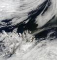
NASA's Terra sees ash plume pulled to the northeast by a low
NASA's Terra satellite continues to provide visible and infrared imagery of Iceland's Eyjafjallajokull Volcano ash plume, and the most recent imagery showed the plume being pulled in a northeasterly direction over the island nation. The brownish ash plume was being pushed to the northeast from a low pressure area situated to Iceland's northeast. The Moderate Resolution Imaging Spectroradiometer or MODIS instrument that flies aboard Terra captured an image on May 18 at 12:20 UTC (8:20 a.m. EDT).
NASA works with other agencies on using satellite observations to aid in the detection and monitoring of aviation hazards caused by volcanic ash. For more on this NASA program, visit: http://science.larc.nasa.gov/asap/research-ash.html.
As weather systems to continue to interact with the ash plume, it will continue to shift, so air travel may always be affected.
Source: NASA/Goddard Space Flight Center
Other sources
- NASA's Terra sees ash plume pulled to the northeast by a lowfrom PhysorgTue, 18 May 2010, 21:00:58 UTC
- NASA's Terra sees ash plume pulled to the northeast by a lowfrom Science BlogTue, 18 May 2010, 20:31:11 UTC
