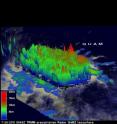
Tropical Depression 11W moving past Yap and Guam
A NASA satellite has observed Tropical Depression 11W become more organized on infrared imagery. Fortunately, it is moving away from land areas for the next couple of days. Yap and Guam are both experiencing the tail end of gusty winds and rains as Tropical Depression 11W moves between the two islands in the western North Pacific today.
At 0900 UTC (5 a.m. EDT) on July 27, Tropical Depression 11W's (TD11W) maximum sustained winds were still near 30 knots (34 mph). It was located about 290 nautical miles southwest of Andersen Air Force Base, Guam near 10.7 North and 140.5 East. It was moving to the northwest near 12 knots (14 mph).
When NASA's Aqua satellite passed over TD11W on July 26 at 16:05 UTC (12:05 p.m. EDT) the center of circulation appeared much more rounded than it had in the previous days, indicating that the storm was getting better organized. The Atmospheric Infrared Sounder (AIRS) instrument captured the infrared image that showed powerful, high thunderstorms with cold cloud tops surrounded the center of TD11W's circulation, although the center is partially exposed to outside winds. There were also a number of bands of thunderstorms around the center. TD11W is kicking up waves of 12 feet high, and generating rough surf at Yap and Guam.
TD11W is moving around the western edge of a low to mid-level ridge of high pressure, and will continue in a northwestward direction for the next day or two. After that, the ridge is expected to weaken and the storm track will head in a more northeasterly direction.
Source: NASA/Goddard Space Flight Center
Articles on the same topic
- Tropical Storm Don analyzed in 3 NASA satellite images13 years ago
- NASA identifies the areas of Tropical Storm Muifa's strength 13 years ago
- NASA eyes Tropical Storm Nock-Ten's heavy rains for Hainan Island and Vietnam13 years ago
- GOES-13 satellite movie shows formation of Tropical Storm Don13 years ago
- NASA measures heavy rain in Tropical Storm Nock-Ten over Philippines13 years ago
- NASA sees Tropical Storm Nock-ten knocking the Philippines13 years ago
- NASA sees dramatic temperatures around Tropical Depression 11W13 years ago
- Tropical Depression 10W bringing rain to the Philippines13 years ago
Other sources
- Tropical Storm Don analyzed in 3 NASA satellite imagesfrom Physorg13 years ago
- NASA identifies the areas of Tropical Storm Muifa's strengthfrom Physorg13 years ago
- GOES-13 satellite movie shows formation of Tropical Storm Donfrom Physorg13 years ago
- NASA sees Tropical Storm Nock-ten knocking the Philippinesfrom Physorg13 years ago
- NASA sees dramatic temperatures around Tropical Depression 11Wfrom Physorg13 years ago
- Tropical Depression 10W bringing rain to the Philippinesfrom Physorg13 years ago


